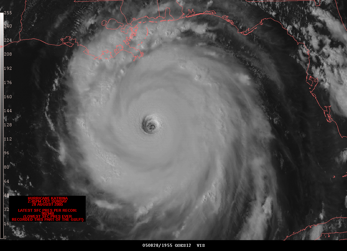
The animated map is a cartographic statement that occurs in time. Its interpretation is based on the human sensitivity to detect movement or change in a display. The image above is a still of an animation clip showing Hurricane Katrina making landfall. This image is from the NOAA website.
No comments:
Post a Comment